Exploration

Exploring the Ochoco mountains by bicycle
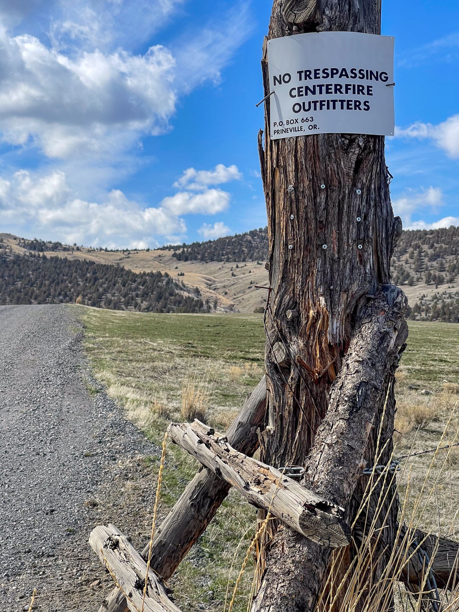
Thinking about where to explore next, we picked a new mountain range, the Ochoco mountains. Well, they truly are a very old mountain range, but we personally had not explored the range. Somehow we had ridden other, perhaps more well known and well traveled Oregon trails, roads and ridges over the past few years, some even quite close to the Ochocos. We tried to ride into the Ochoco mountains. We came to the edge a few years ago while poking around the John Day river, the Sutton Mountains and Mitchell, Oregon. We tried to ride into them, but turned around at some No Trespassing signs along a road. Sometimes, the No Trespassing signs are on the side of the road, on a fence post, yet angled to imply that the entire road is private.
So we picked the Ochoco range for June and in the spirit of the 2020’s, I asked Claude for thoughts about riding in the area. A few road loops came up. DirtyFreehub had a ride, Mitch & Walt. There are a few formal campgrounds and there is quite a bit of dispersed camping on BLM and National Forest land.
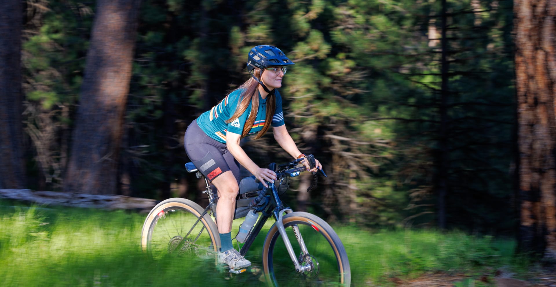
We pack up and head out (knowing we will forget something kind of essential – that seems to be a tradition!). I have a pretty good stash of bicycle spare parts, lube, brake fluid, tools etc in an old camera bag, gradually increased in pieces over the years of needing something and I load the bag in the car. I remove pedals, wheels and derailleurs, putting together the jigsaw puzzle that fills the back of the vehicle. Amy packs up her list of camping gear and food and we select clothing for to fit the weather report.
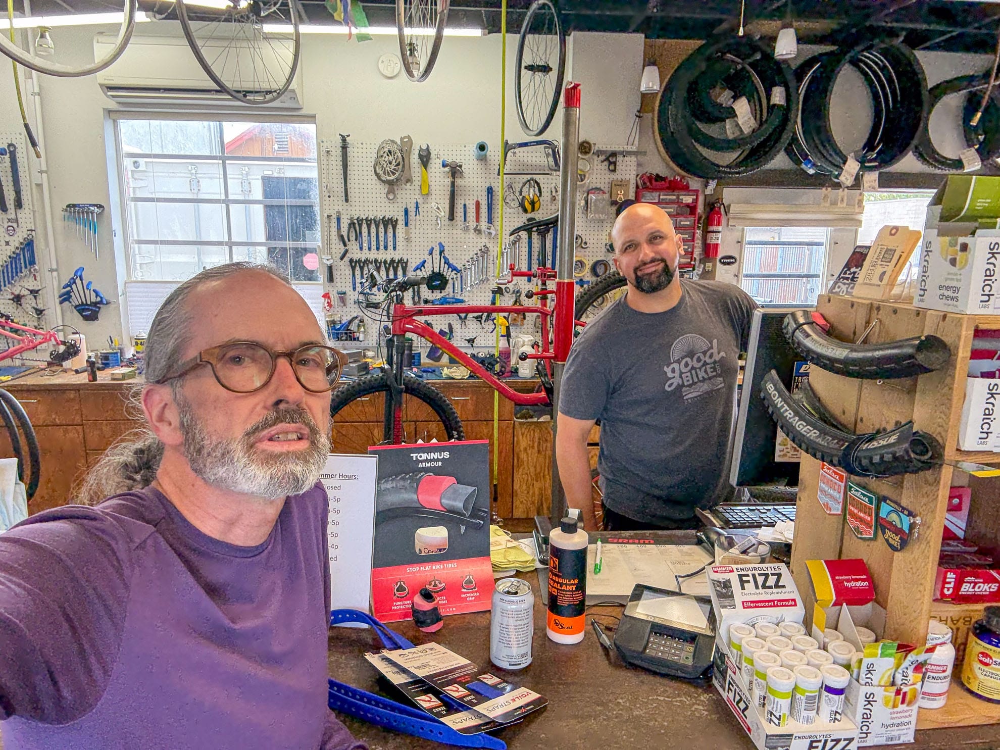
On the road trip, we stop in Prineville, the closest community and chat a bit with James at Good Bike Company. He seems to like the riding in the Ochocos.
It’s difficult to know where to head, even with beta. I think my brain is organized geographically. Until I actually wander an area, I don’t grasp fully what someone, or a map or a description is telling me. After a visit, a good map carries a lot of meaning and can transport me back to where I’ve been.
Turns out the Ochoco mountains aren’t a random set of bumps. There is a spine. The Ochocos are the west end of the Blue Mountains, stretching across Central Oregon and curving up into southwest Washington, near Walla Walla. For the next few days we select the Ochoco Divide Campground, which is on one of the main highways crossing this end of the mountain range. I remember the road from previous cycling as one where vehicles travel fast and the shoulder is poor. That remains true.
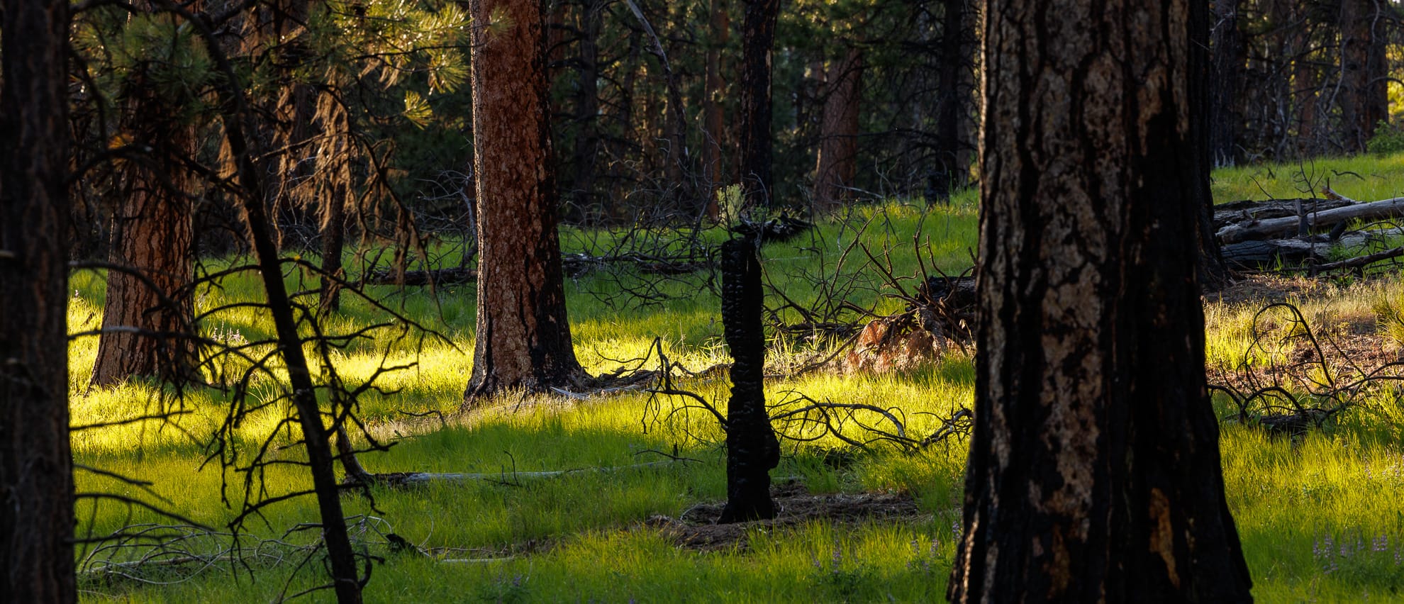
We pull into an uncrowded campground, find a magnificent site at the south end. The sites are spread out a comfortable distance from each other. We can see other campers, RV’s and tents, but setting up, it seems moderately private off the campground loop. After setting up camp, we head out for an evening exploration. We are camping at 1400 m elevation and the air temperature is pleasant.
Summer evenings are long, and the sun’s rays are angled, streaming through the tall timber. The trees are spread out. I am most mesmerized by all the shades of green. We wander cycle up the nearest Forest Service road, 2630, stop to look at the Gaiagps map, and there is a trail crossing the road. Off to the left, I hear someone chopping wood, apparently working on the trail. Since we haven’t seen anyone since leaving the campground, I start up the trail. The sound stops. Suddenly, I catch movement, and there is a large brown head, moving away from me, who stops, turns and momentarily gazes into my eyes. Its face seems human. I turn around to catch Amy's attention and turning back the creature is gone. I think I’ve just seen Sasquatch. Of course, I know that’s not true and it must’ve been a deer, or something else, but the face looked human in the evening light. We backtrack and decide to take the trail on the right side of the road.
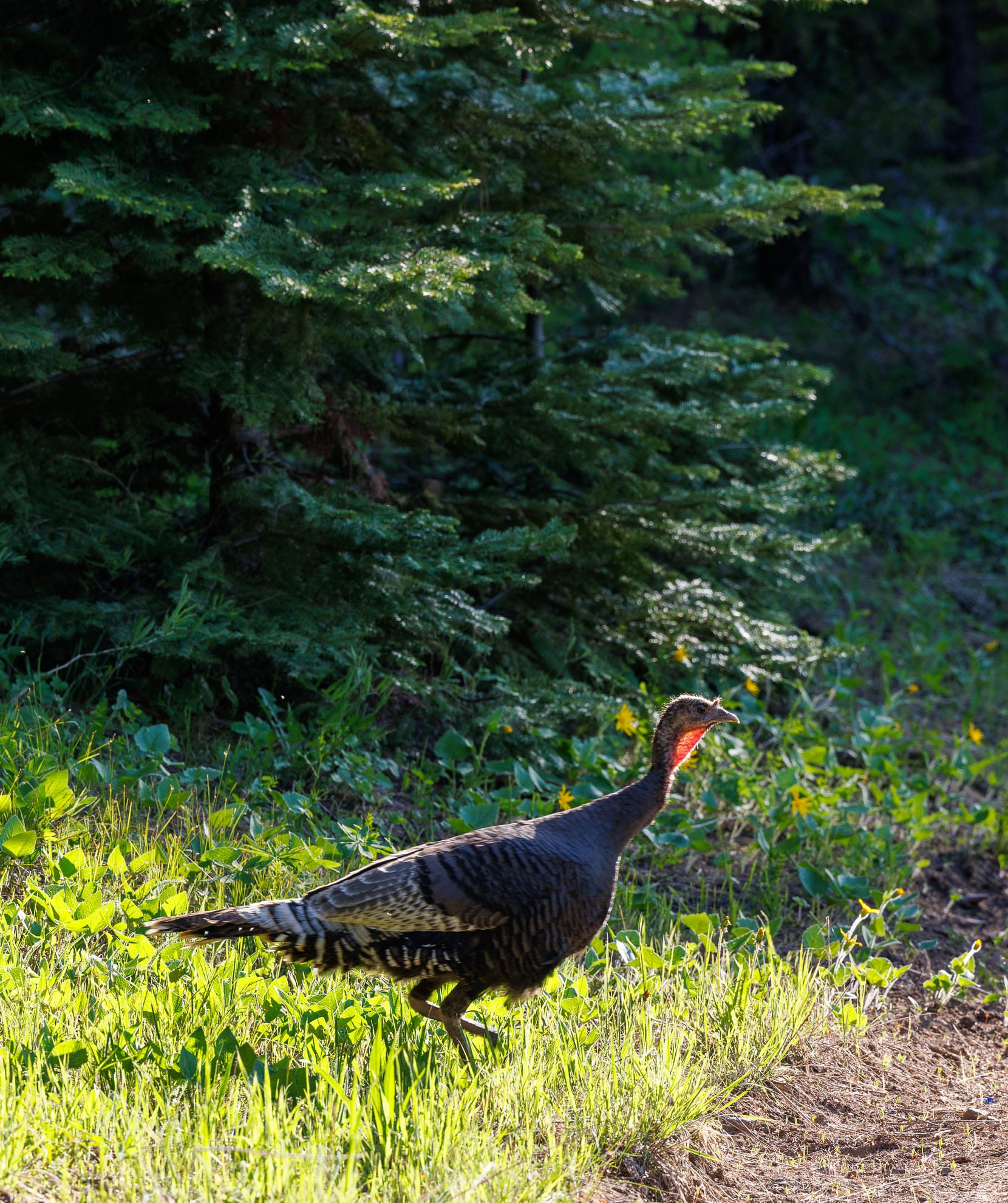
It is double track, an old forest Road returning to nature. Amy moves along up ahead. There’s a sudden beating to the left of my wheel. A turkey blasts out of the grass near my left foot. I suspect there might be a nest nearby, since she doesn’t take off into the woods. Rather she ends up circling me for 360 degrees, cackling. She must have remained calm and hidden while Amy rode by her.
The trails have been cleared of all debris. We can see some fresh wood chips where logs have been sawyered. We stop and listen to all the birds singing in the evening. The moon is up over the tops of the trees.
The suns rays move lower, to near horizontal and backlight the swaths of purple lupine. The Ochoco Way is maintained by COTA Mountain Bike out of Bend. I later find on Instagram that the trails were cleared of winter fall down only two days ago. Large ponderosa pine cones have accumulated in the trail, flicking the bike wheels around as we ride through them. Trails are duff covered and tacky. This is early season riding at its best.
Back at camp, there are clouds of bugs in the evening light. They aren’t terribly bothersome, but it is nice to have a lightweight netting tent to get into later.
On our second days ride, we climbed to the top of the ridge, about 1800 m. I turn left at a fork and not knowing which way to go, I pull off into the shade to look at the map. Underneath the tree, there’s a sign post for Scotty’s Creek. I serendipitously have pulled off at a trailhead. Why not descend! It turns out there’s not a lot of flow and the trail plunges rapidly. Halfway down, we decide to split off onto a forest service road which has a much gentler gradient. It hasn’t been driven in a while, and there are a few small trees across it.
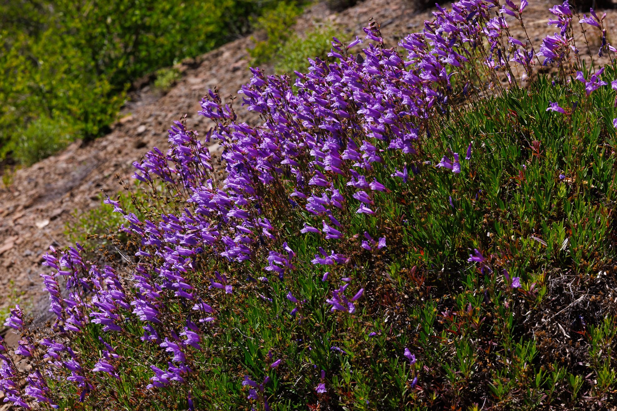
Along the road berms are Penstemon flowers, a brilliant purple.
Back at camp we brew some coffee. In the evening, I can go exploring the trails close to camp and there are quite a few. I find Bandit springs, a lovely meadow. We gradually explore more of the close in trails over the next two weekends as well as some of the gravel roads in the area. We do encounter some private property blocking apparent access routes on the GaiaGps maps and turn around once. Mostly though we are impressed by the beautiful riding, from the Larches on the tops of the ridges to the Juniper in the drier valleys.